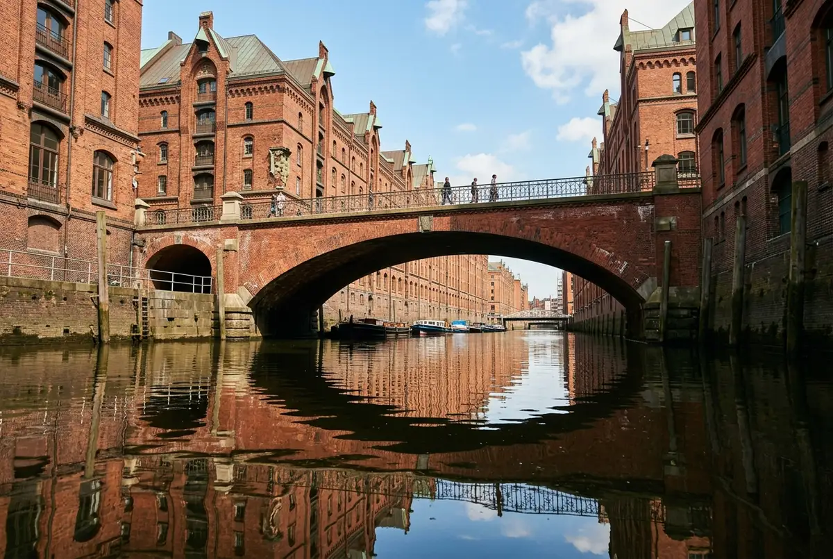
Hamburg bridges how many is one of those questions where the real number genuinely surprises people: the city is widely credited with more than 2,500 bridges, more than Venice and Amsterdam combined, built up over centuries of canals, locks, and a working river port. Here is the fact I would actually lead with if you only remember one thing from this page: Hamburg’s identity as a water city runs far deeper than its famous harbour alone. My honest first-timer’s guide to visiting Hamburg covers why that water-first identity is worth planning a trip around.
How many bridges does Hamburg actually have?
More than 2,500 by most commonly cited counts, a figure that regularly gets repeated as higher than Venice, Amsterdam, and London combined, though exact tallies vary depending on what counts as a bridge.
I would treat the precise number as a fun fact rather than something to verify down to the last digit, since different sources draw the line differently between a full bridge and a smaller footbridge over a drainage canal. What matters more for a visitor is what the number represents: an unusually dense network of waterways running through almost every part of the city, not just the harbour you see on a postcard.
Which river flows through Hamburg?
The River Elbe, one of central Europe’s major rivers, flows directly through Hamburg on its way to the North Sea, and it is the reason the city grew into one of Europe’s largest ports in the first place.
I think this is the single fact that explains most of what makes Hamburg interesting to visit. The Elbe’s width and depth at this point let large cargo ships reach far inland, which built the working port a harbour cruise sails through today. Without the Elbe, there is no Speicherstadt, no container terminals, and really no reason Hamburg became the city it is now. The Elbe’s own Wikipedia entry covers the river’s full course if you want the wider geography beyond just the Hamburg stretch.
What is the Alster, and how does it fit in?
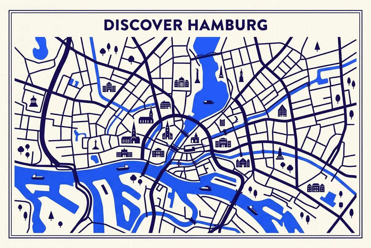
The Alster is a separate river that flows into the Elbe, widening within the city into two artificial lakes, the Binnenalster and the larger Aussenalster, that give central Hamburg a genuinely different, calmer body of water than the harbour.
I would not confuse the Alster with the Elbe when planning a boat trip, since they are two distinct experiences on two different bodies of water, a calmer lake-side loop versus a working harbour route, even though both sit inside the same city.
What are the Fleete, and are they different from the Elbe and Alster?
The Fleete are a network of narrow canals running directly through Hamburg’s old town and the Speicherstadt warehouse district, distinct from both the open Elbe and the Alster lake, and small enough that only certain boats can navigate them.
I would call the Fleete the most atmospheric of Hamburg’s three water systems, since they are what give the Speicherstadt its famous red-brick-rising-from-water look, even on a short visit that only has time for one canal stretch.
Why does Hamburg have so many bridges in the first place?
Centuries of canal building through a low-lying, water-dense landscape, combined with a working port that needed constant road and rail connections across the harbour and the Fleete canals, produced a bridge count that grew steadily over hundreds of years.
I would see this less as a planned record and more as the natural result of building a major trading city on genuinely difficult, water-cut terrain. Every warehouse in Speicherstadt sits on piles driven into water, and every one of those warehouse blocks needed a bridge or two just to stay connected to the next one over.
Can you actually see a lot of these bridges from a harbour cruise?
Yes, a meaningful number of them, particularly through the Speicherstadt stretch where narrow brick bridges cross directly over the boat’s route at a height low enough to really notice from the water.
I would specifically watch for this stretch on a cruise rather than treat the bridges as background scenery, since passing directly underneath some of them is one of the more memorable few minutes of the trip. The Hamburg Harbor and Speicherstadt Day Cruise runs this exact route, tide permitting, in about 1.5 hours from EUR 34. Check the route and current availability here if this stretch is the part of Hamburg you most want to see.
Does the Elbe affect what a harbour cruise can actually show you?
Yes, directly. Tides on the Elbe determine whether a cruise can enter the narrower Speicherstadt canals on a given sailing, since water levels there need to sit within a workable range for the boats used.
I would not treat a guaranteed Speicherstadt stretch as certain on every booking for this reason, and most operators are upfront that the route can shift to the open harbour instead when the tide does not cooperate. My page on the Port of Hamburg’s history and facts goes further into how this working river shaped the city above the water as much as below it.
Is Hamburg really the bridge capital of the world, or just of Europe?
Most of the commonly repeated claims stop at Europe, crediting Hamburg with more bridges than any other city on the continent, rather than a confirmed global record, since a handful of cities elsewhere make similar claims using different counting methods.
I would treat the “world capital of bridges” framing you sometimes see online as marketing shorthand rather than a verified title, while the narrower claim, more bridges than any other European city, holds up consistently across the sources I would trust. Either way, the practical takeaway for a visitor is the same: water and bridges are everywhere here, not just around the obvious harbour.
Do the bridges in Speicherstadt have their own names and history?
Yes, many of the bridges inside the Speicherstadt carry individual names tied to the merchants, streets, or warehouse blocks they connect, a detail that goes back to the district’s founding in the late 19th century as a free trade zone for storing goods straight off incoming ships.
I would not try to memorise individual bridge names before a visit, since there are simply too many of them packed into a small area. What is worth knowing is that the density of named, individually built bridges in this one district is itself part of why Speicherstadt earned UNESCO World Heritage status, not just the warehouses sitting above the water.
Is there a best time of day to see Hamburg’s bridges and canals?
Early morning or the hour before sunset tend to give the best light on the water and the quietest piers, since the Speicherstadt canals photograph noticeably better without the midday crowd and harsher overhead sun.
I would plan a morning cruise if photography is a priority, for this reason alone, and build the rest of the day around it the way my one-day Hamburg itinerary lays out. My guide to Hamburg’s weather and the best season to visit goes further into which months give the most reliable light and comfortable deck conditions.
My recommendation
If you only read one section, read this: Hamburg’s water identity runs on three distinct systems, the Elbe, the Alster, and the Fleete canals, stitched together by a bridge count that genuinely outnumbers Venice and Amsterdam combined. I would see at least the Elbe and the Fleete stretch from a boat rather than only on foot, since the scale and the bridges are easiest to appreciate from the water itself. My full Hamburg cost and budget guide and my guide to getting to Hamburg are worth reading next if the practical side of a trip still needs sorting, and my side-by-side comparison of every Hamburg boat tour is the place I would start picking which route covers the most of this geography in one sitting.
Frequently asked questions
Is it true Hamburg has more bridges than Venice?
Yes, by most widely cited counts, Hamburg’s bridge total comfortably exceeds Venice’s, and the usual comparison stretches to include Amsterdam as well, with Hamburg still coming out ahead of both combined.
What river is the Hamburg harbour actually on?
The River Elbe, which carries the working port and most of the sightseeing route a harbour cruise follows, separate from the Alster lake in the city centre.
Is the Alster a river or a lake?
Both, technically. The Alster starts as a smaller river that widens into two lakes, the Binnenalster and Aussenalster, within Hamburg itself before eventually joining the Elbe.
Can you walk across most of Hamburg’s famous bridges?
Yes, the great majority are small pedestrian or local road bridges throughout the city and the Speicherstadt, rather than large landmark structures, which is part of why the total count runs so high.
Does every Hamburg boat tour pass under some of these bridges?
Most do, particularly any route touching the Speicherstadt or the Alster lake, though the exact bridges you pass depend on which specific cruise and route you book.